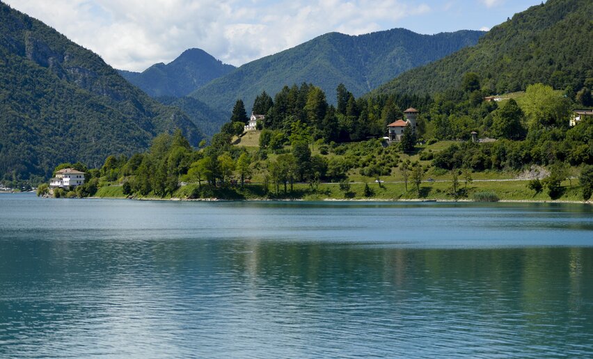
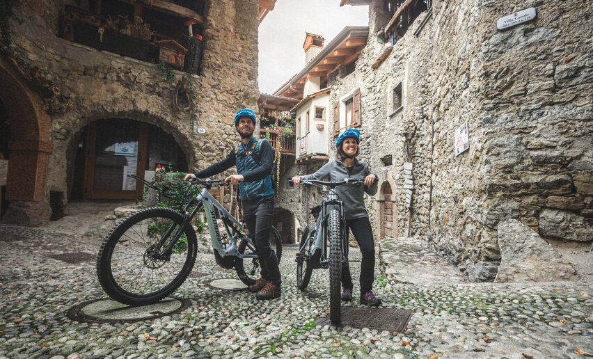
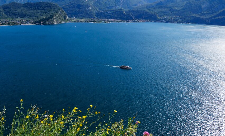
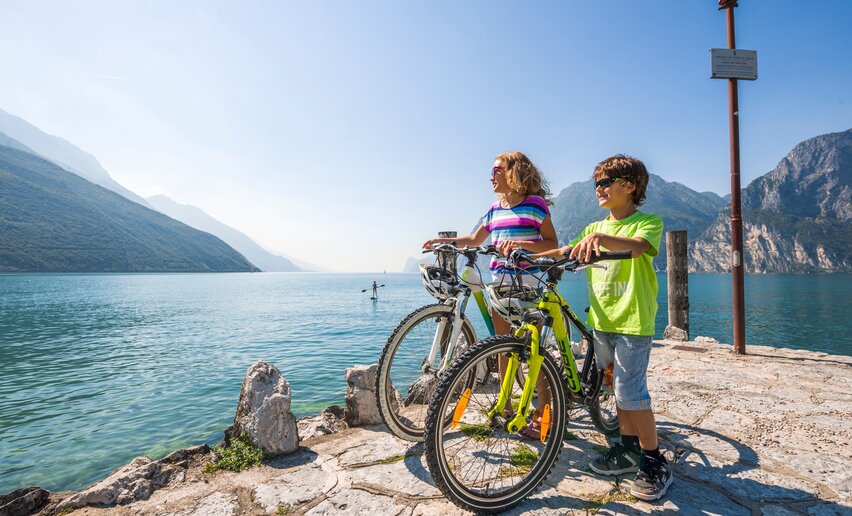
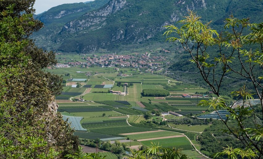
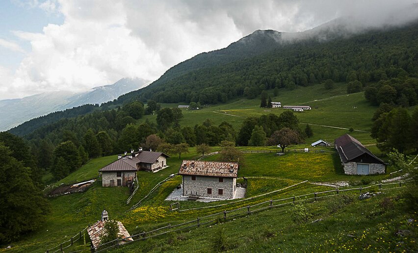
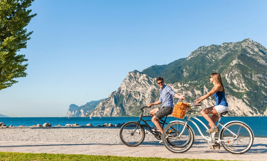
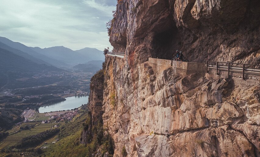
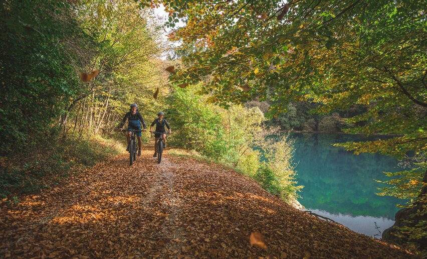
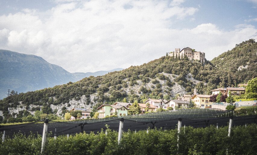
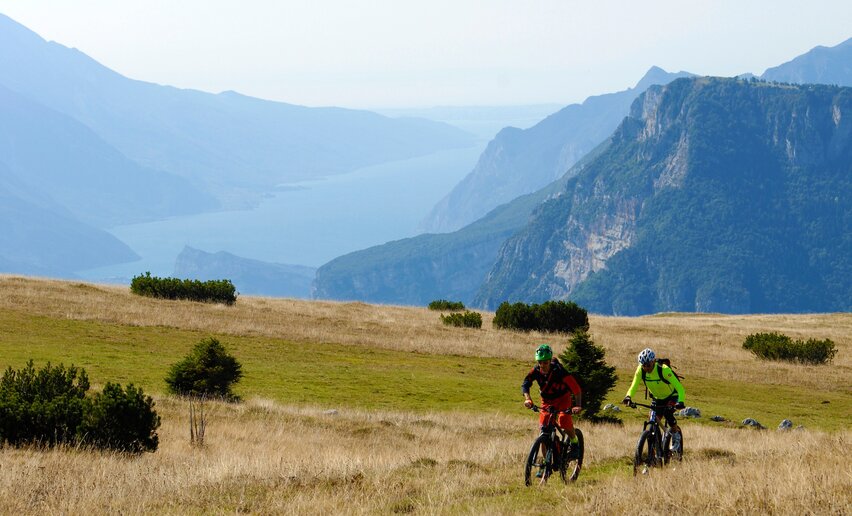
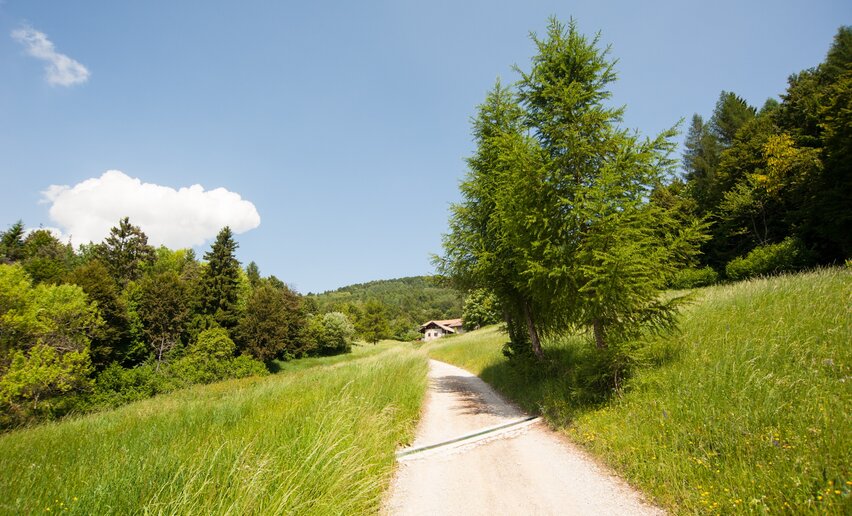
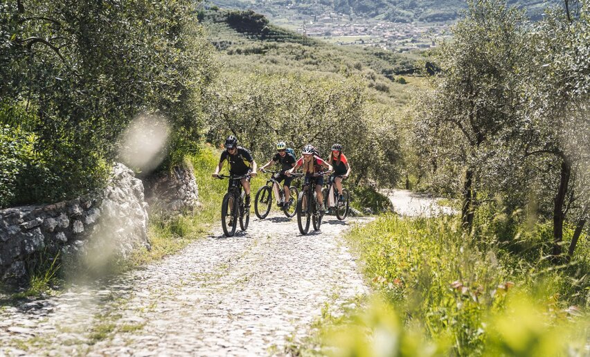
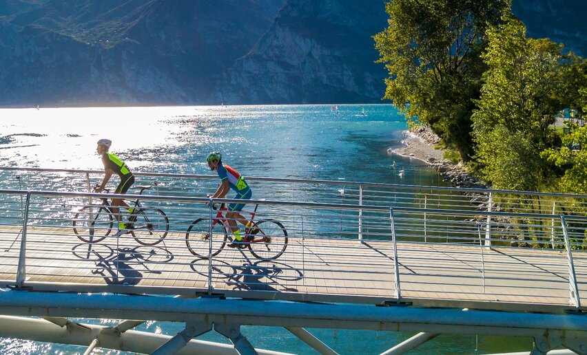
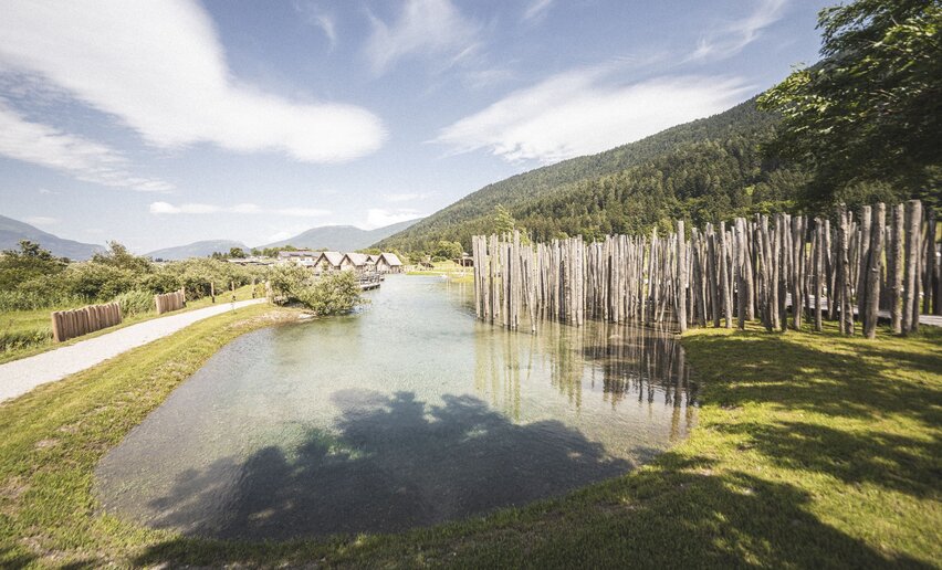
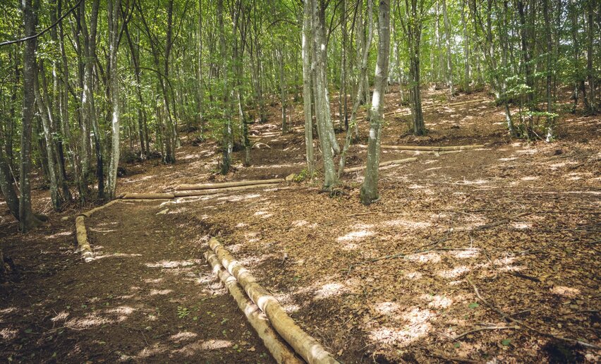
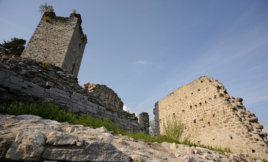
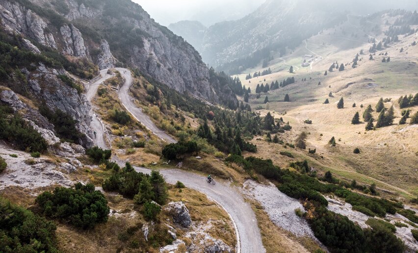
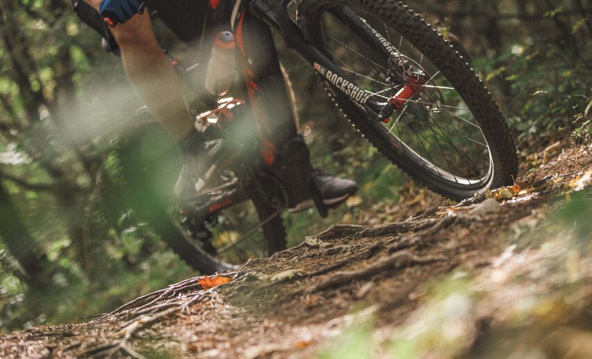
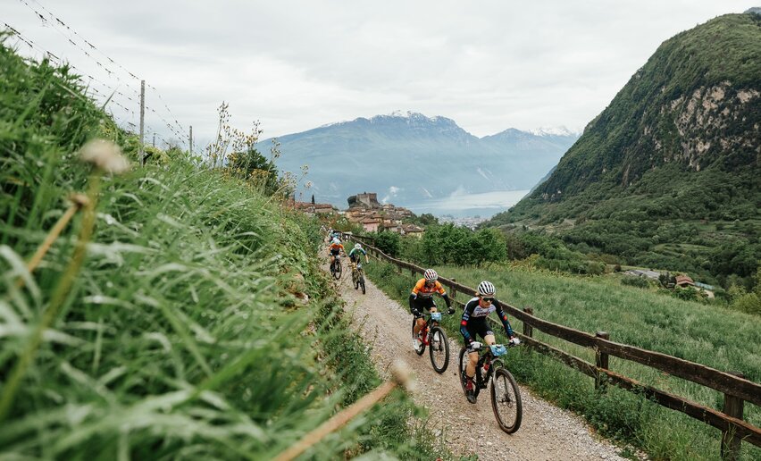
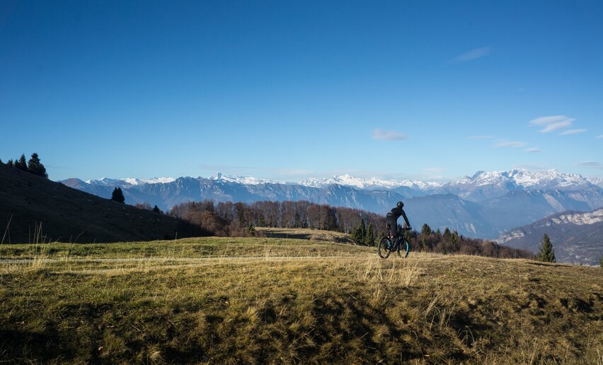
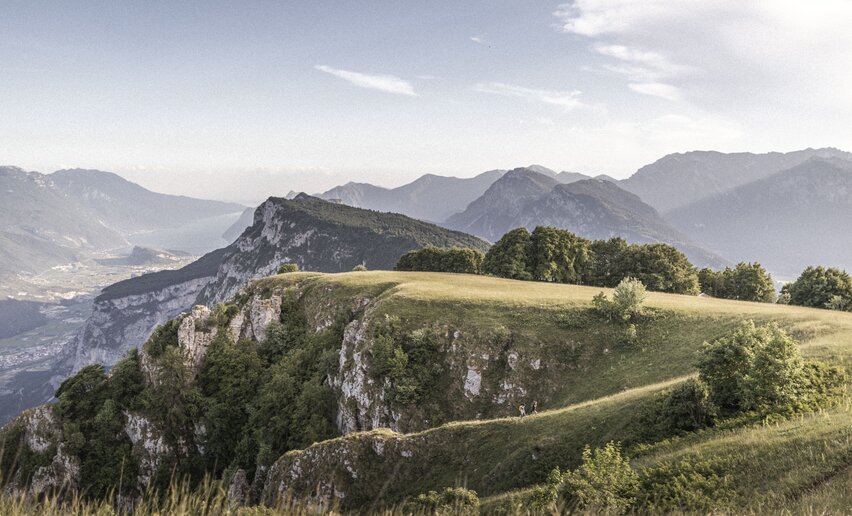
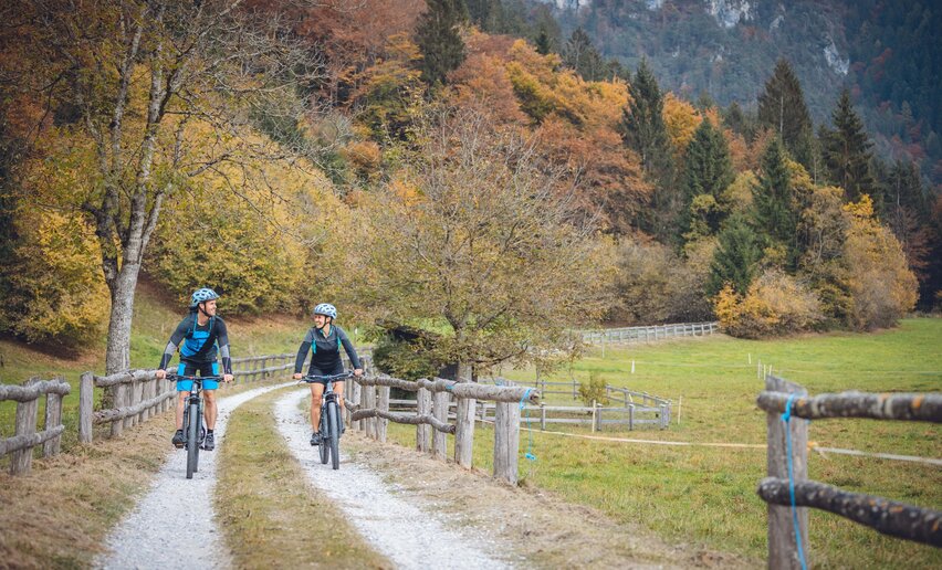
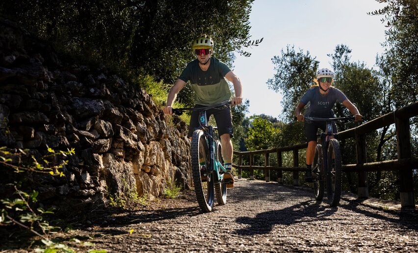
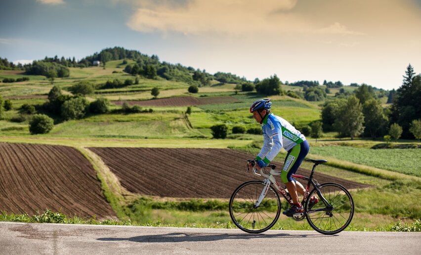
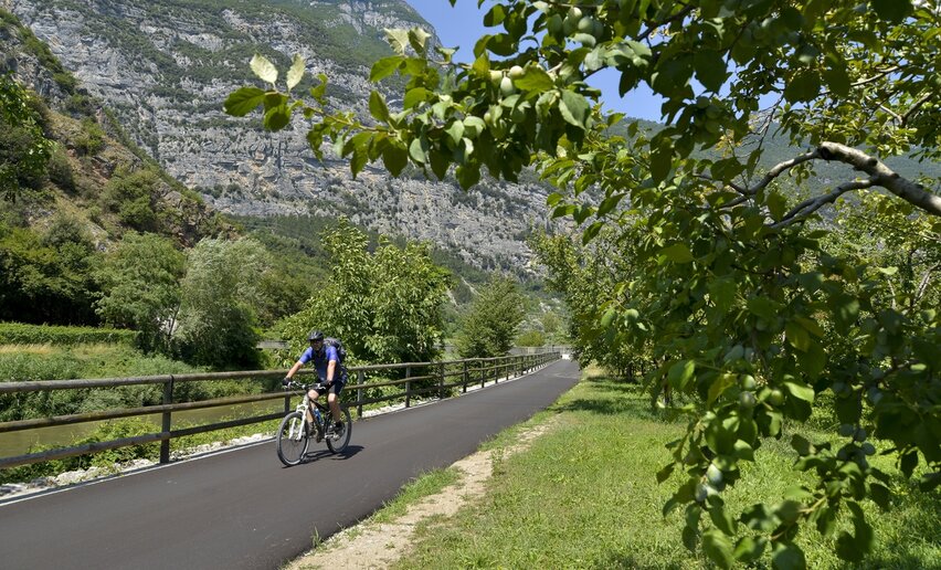
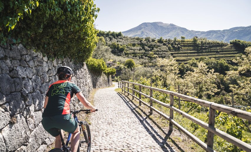
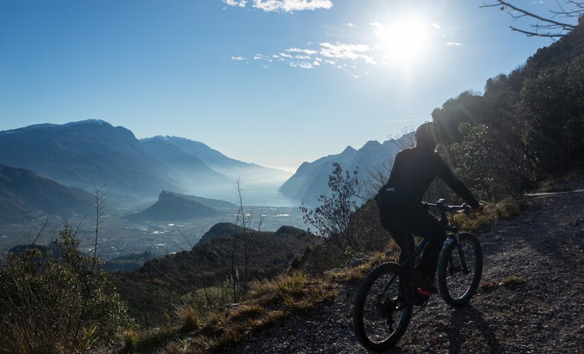
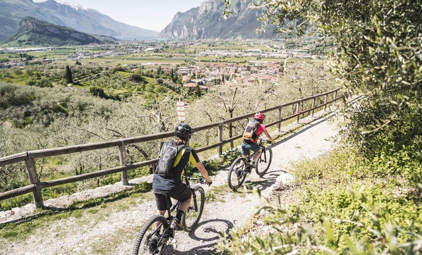
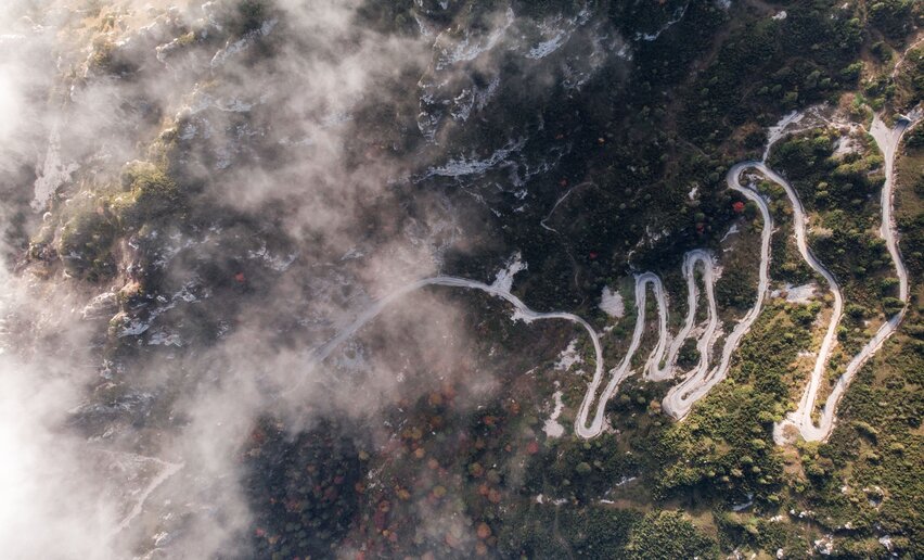
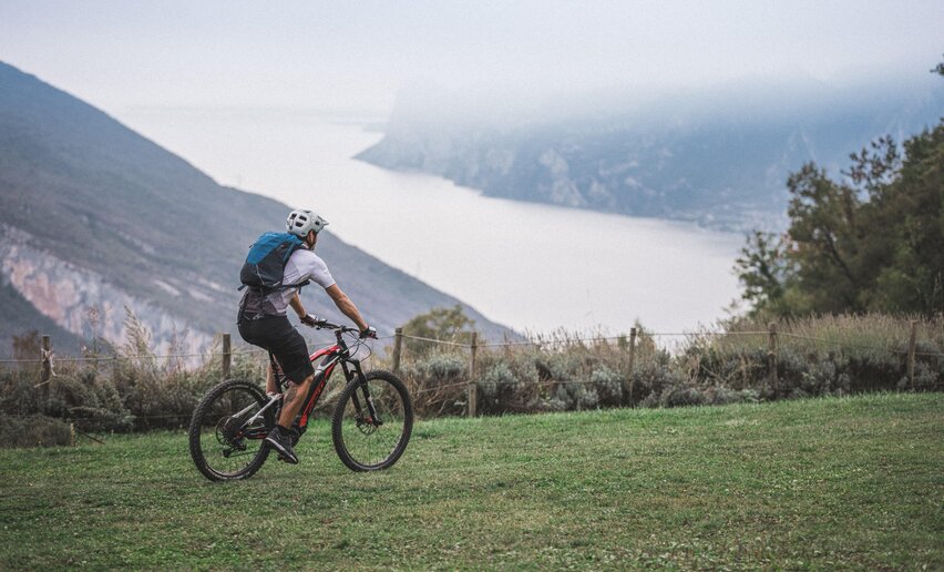
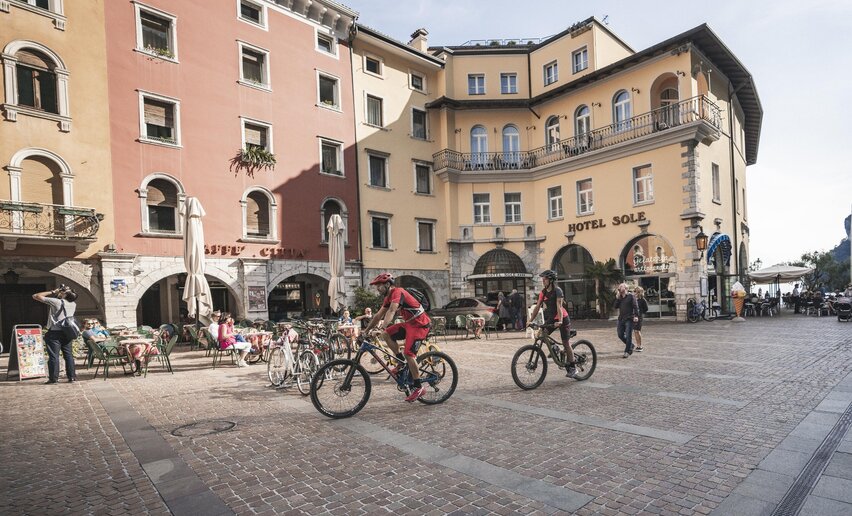
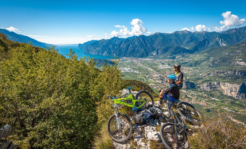
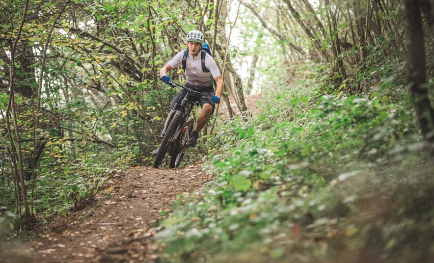
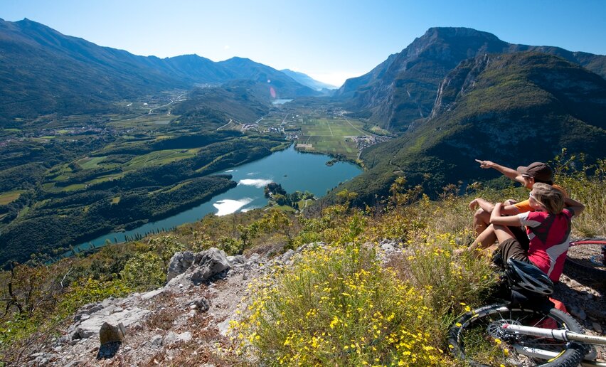
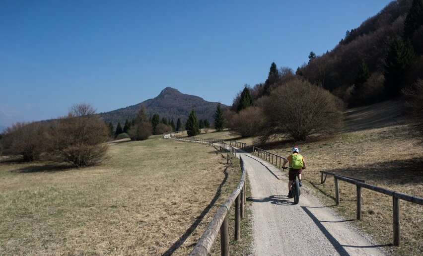
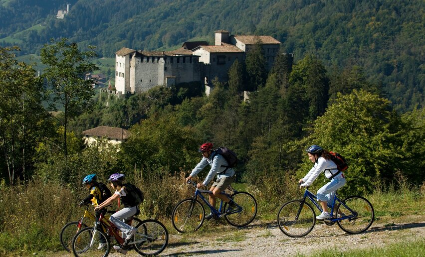
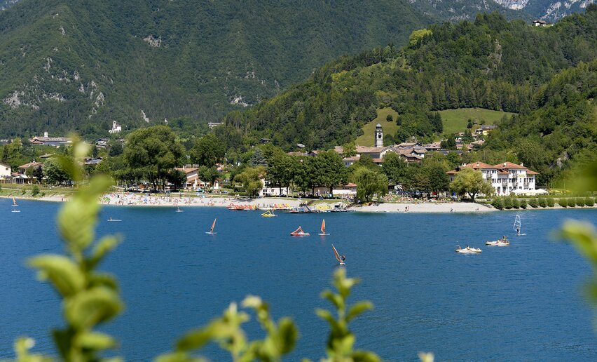
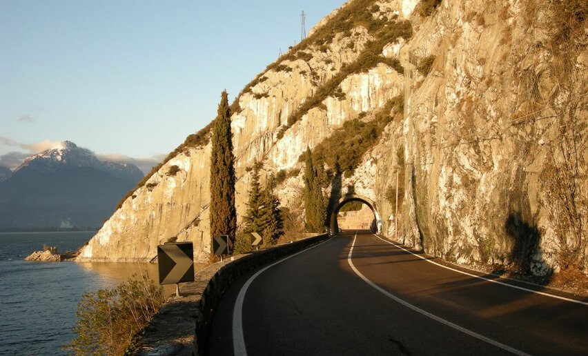
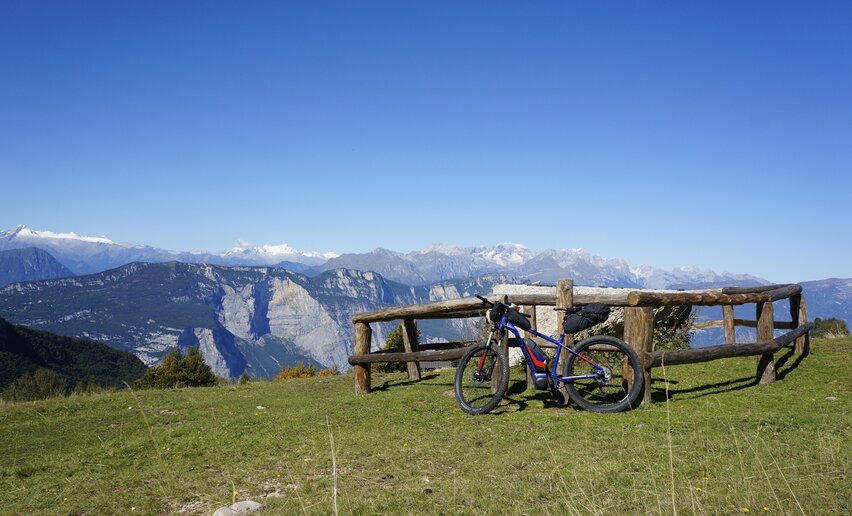
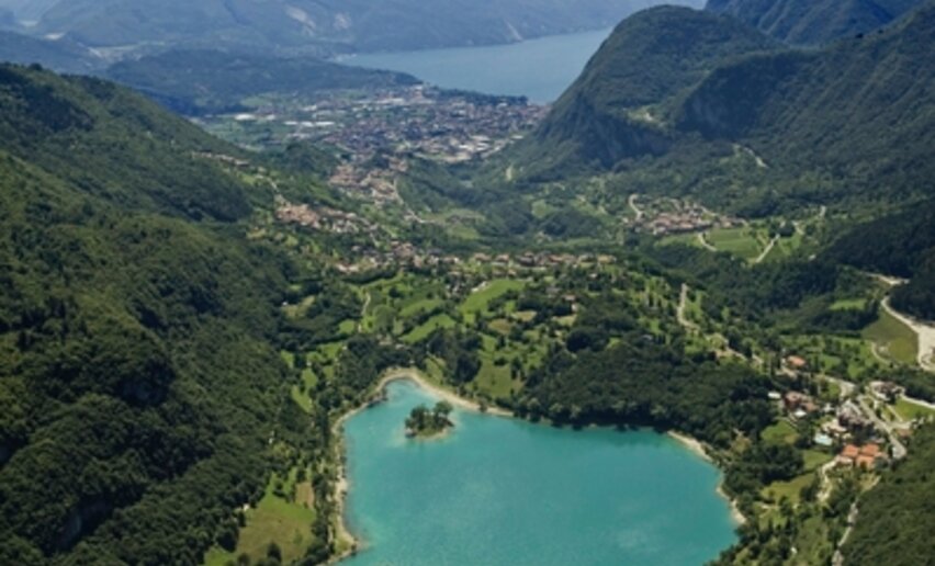
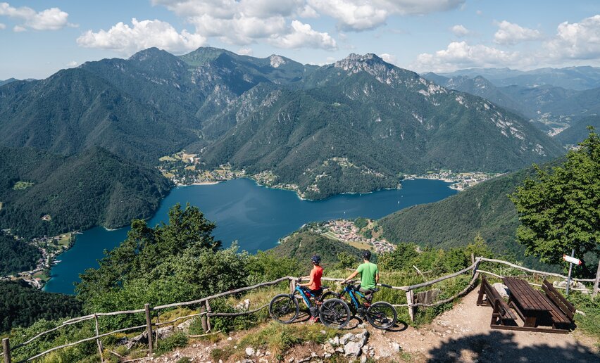
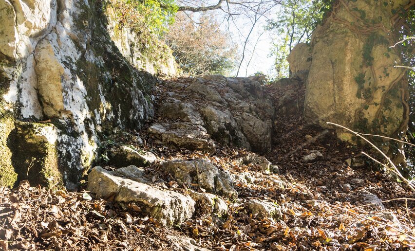
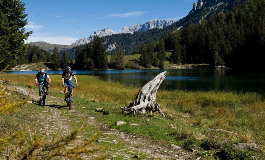
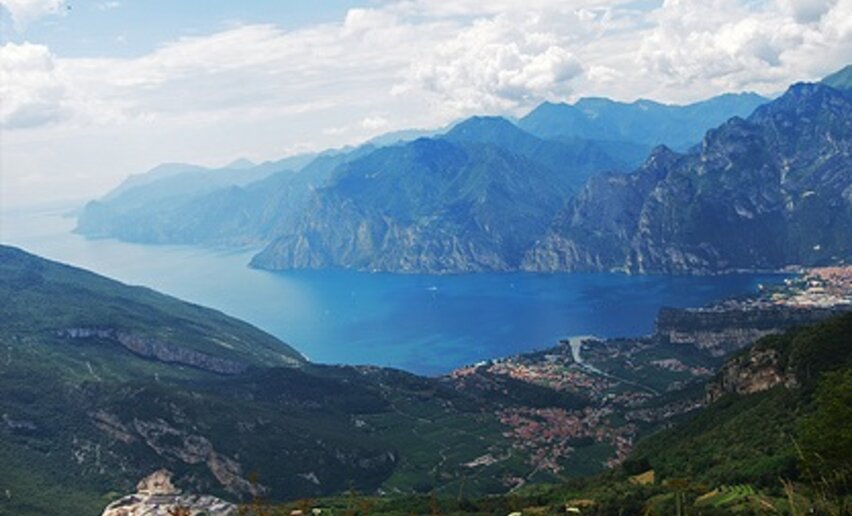
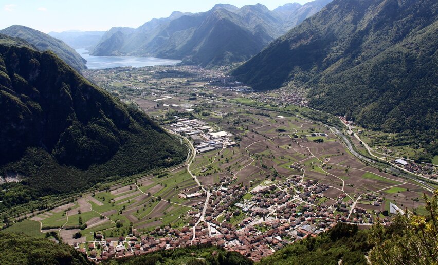
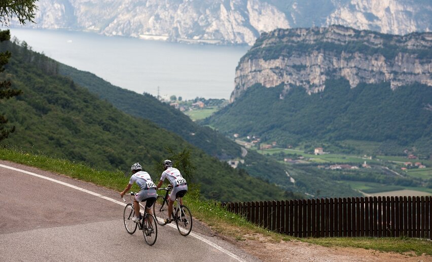
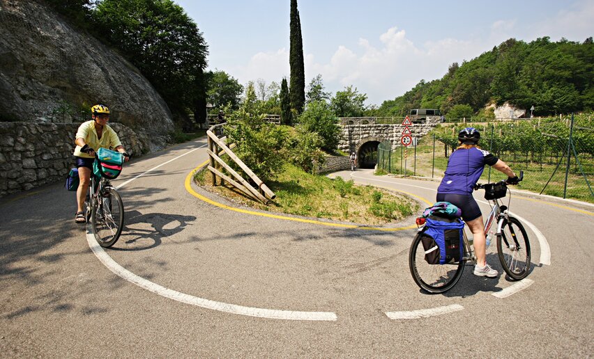
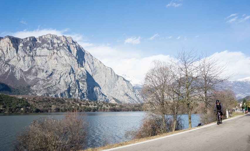
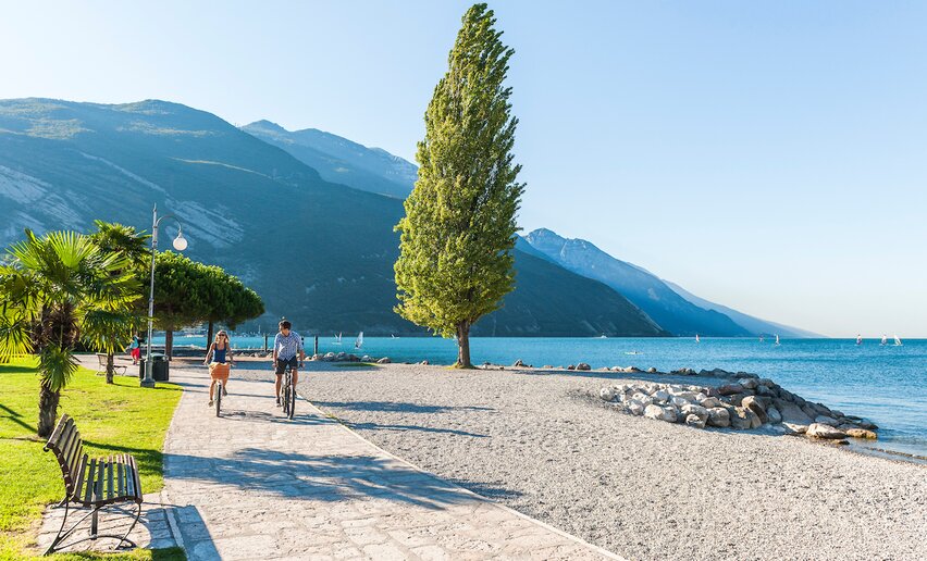
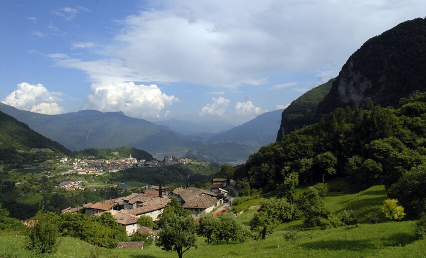
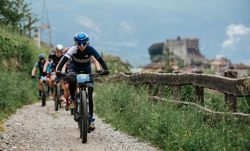
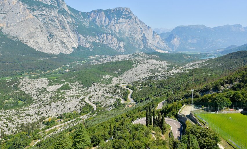
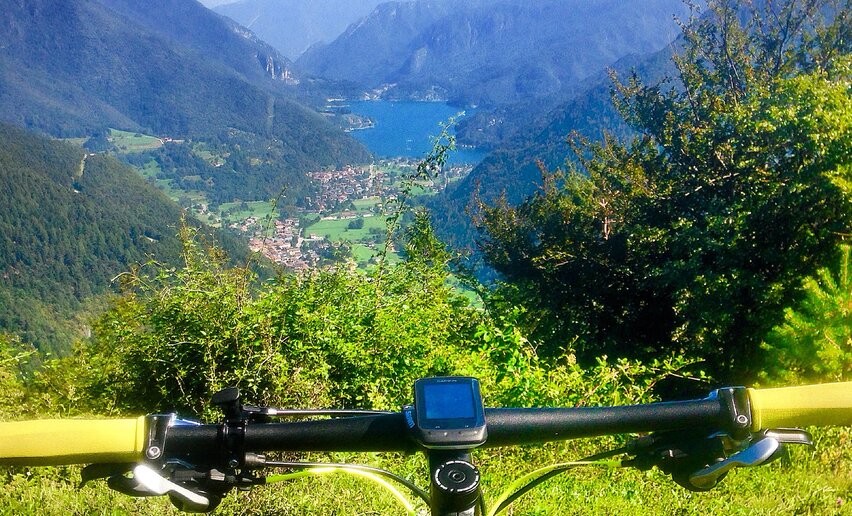
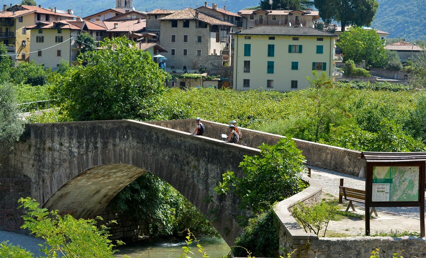
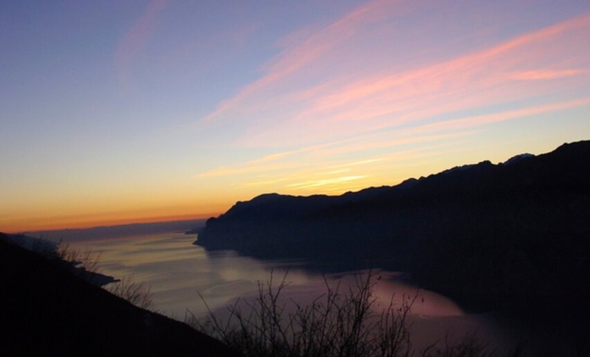
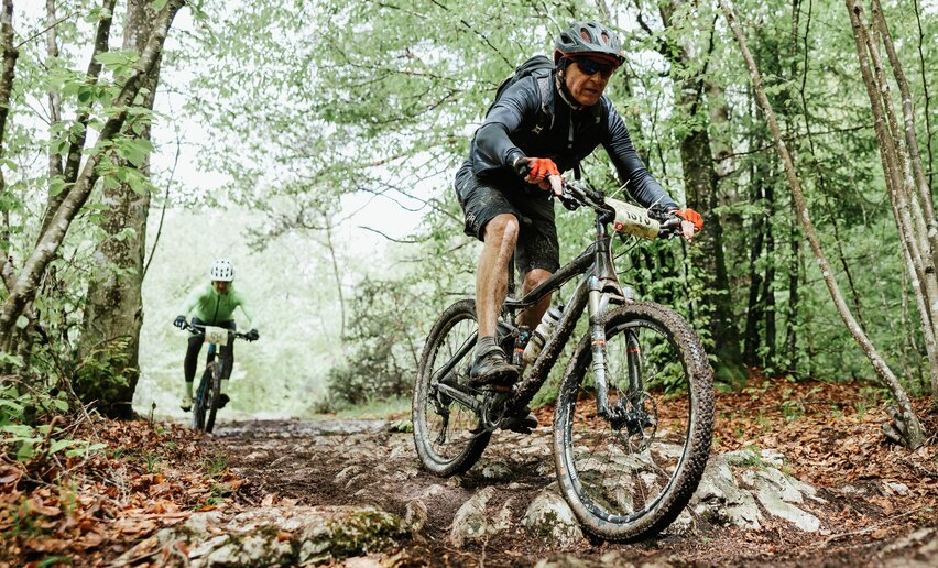
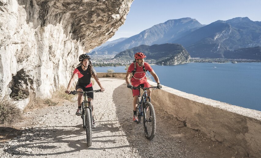
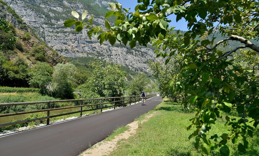
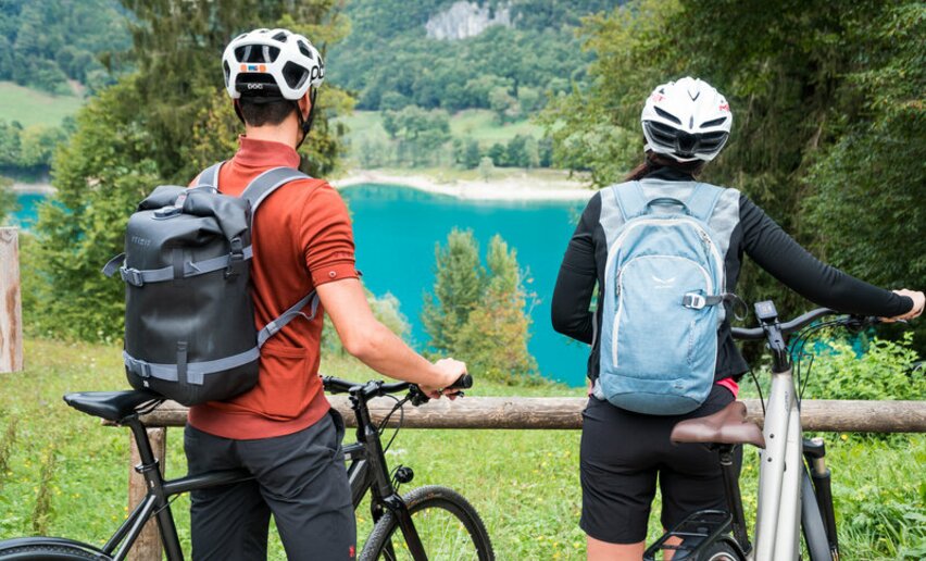
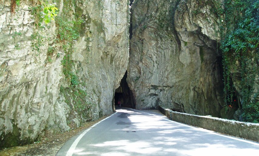
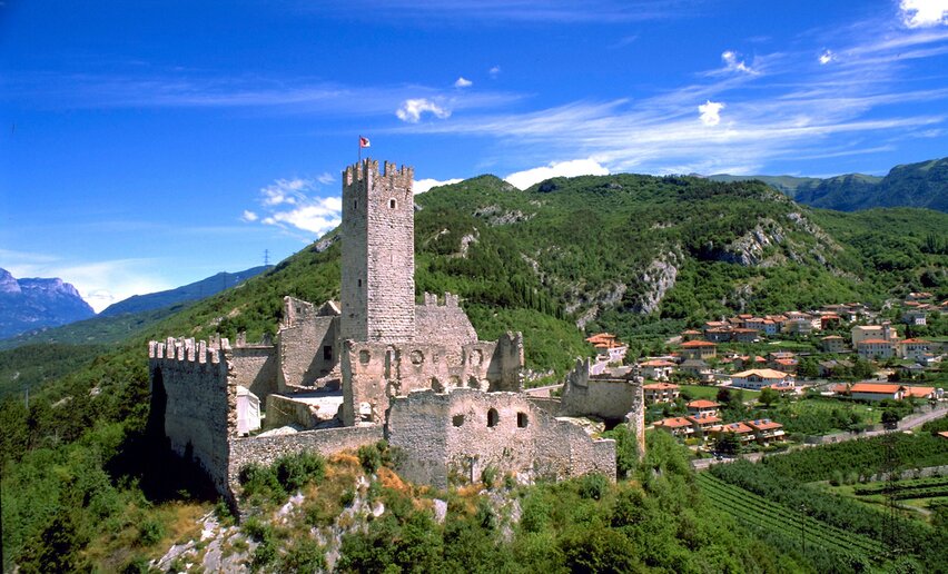
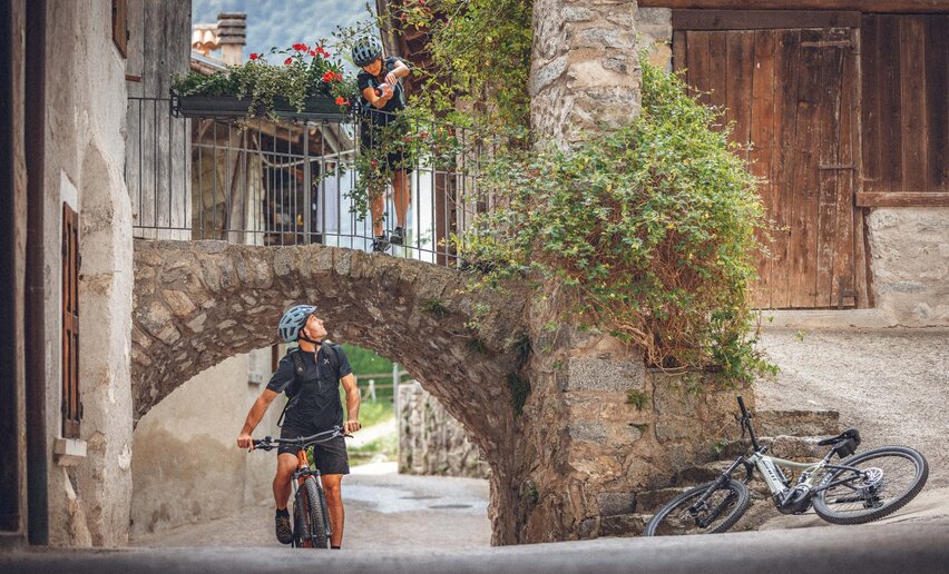
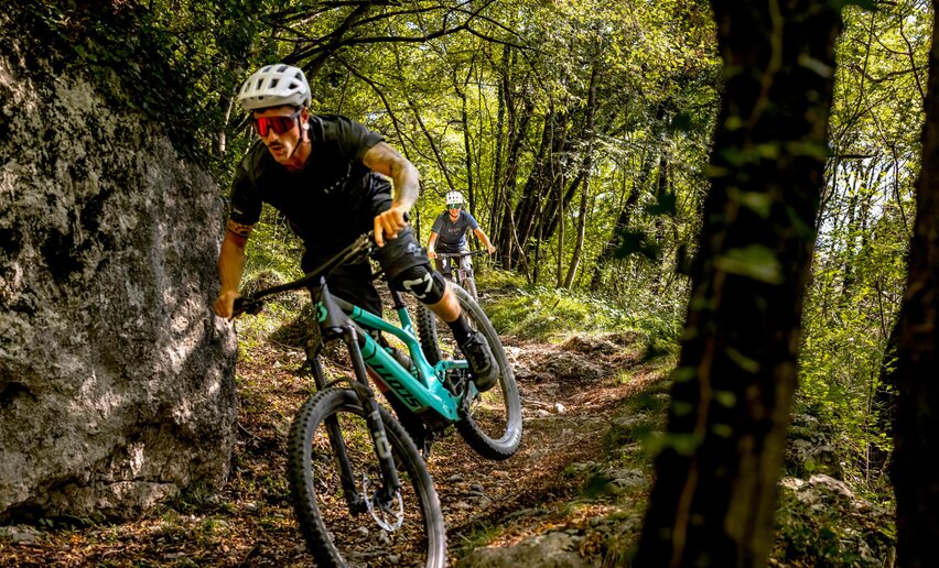
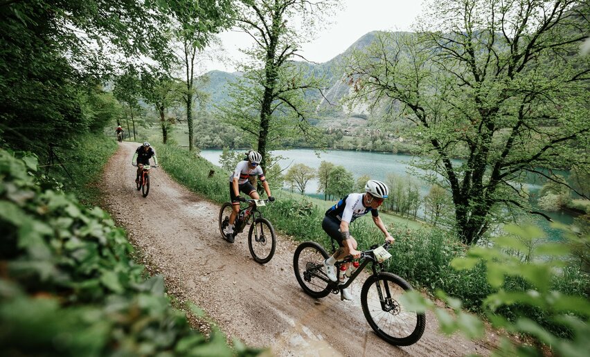
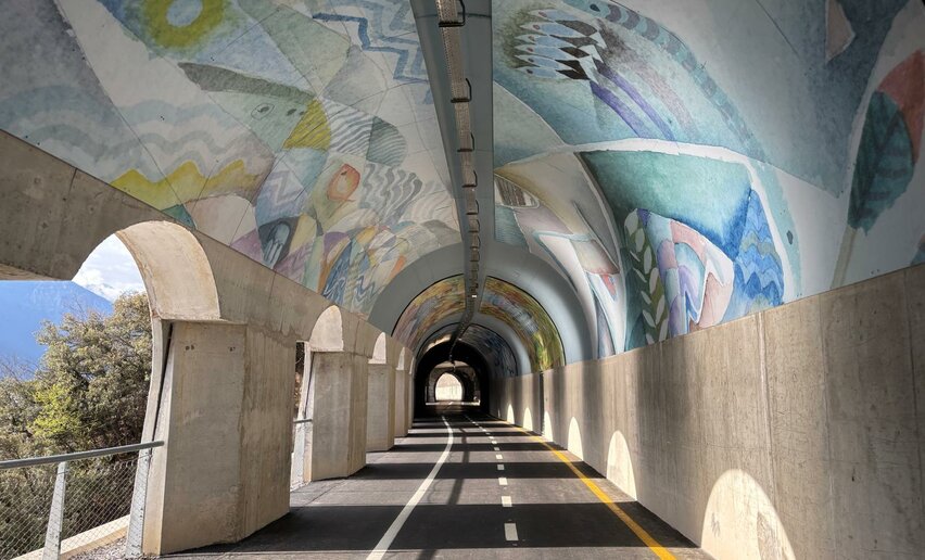
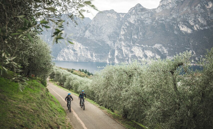
MTB TRAILS AND TREKKING ROUTES OPPORTUNITIES IN GARDA TRENTINO BIKE ARENA WITH TECHNICAL BRIEF DESCRIPTION AND FREE DOWNLOAD GPS TRACKS
773. Ronda Extremamountainbiking+ INFO (GPX KML)Duration: h 8:00Length: 88,8kmAscent: 1.419mDifficulty: DifficultRiva del GardaSan Giovanni al Monterace cycling+ INFO (GPX KML)Duration: h 2:30Length: 32,4kmAscent: 1.001mTwenty small bends take us to the San Giovanni al Monte area, at an altitude of 1050 metres above sea level. Its exceptionally taxing climbs are rewarded by astounding views. Difficulty: IntermediateRiva del GardaKilometroZero UNESCO Bike Tourmountainbiking+ INFO (GPX KML)Duration: h 5:30Length: 63,3kmAscent: 448mLive an unforgettable experience on your mountainbike! Kilometrozero bike tour is the new path that allows you to combine your bike passion with the italian food! Discover Comano ValleSalus and its gastronomic jewels riding your mountainbike, ebike or road bike!
What does Kilometrozero consist of? ZERO: because the products you will taste are zero-mile grown ZERO: the final balance sheet of the burned/assimilated calories at the end of the tour.
A bike tour thinked up for those who:
love cycling and enjoy the pleasure of good eating
believe in sustainability, natural products and short distribution chain
hate food bar and energy booster
Difficulty: IntermediatePonte Arche - Terme di Comano772. Ronda Grande (All Mountain)mountainbiking+ INFO (GPX KML)Duration: h 6:30Length: 74,7kmAscent: 1.415mThe former intermediate route of a competition held every year on the occasion of the Bike Festival. It is suited to cyclists with a high level of physical but also technical preparation.Difficulty: DifficultRiva del GardaTenno - Ballino - Comanorace cycling+ INFO (GPX KML)Duration: h 4:55Length: 59,5kmAscent: 704mA pleasant route, suitable for all levels of cyclists. A continuous series of ups and downs on the trail of the locations in the Bleggio and Lomaso areas.
Difficulty: IntermediateRiva del Garda - Info office779b. Variante Caset Pubregn - Trailmountainbiking+ INFO (GPX KML)Duration: h 2:00Length: 12,3kmAscent: 986mA direct link between Tremalzo and Lake Ledro which demands good confidence on two wheels.Difficulty: IntermediateTremalzo729. Lago di Ledro - Tourmountainbiking+ INFO (GPX KML)Duration: h 3:30Length: 16,5kmAscent: 381mThis easy tour combines lakeside stretches with a detour along the Coste di Bariolo forest road. Stunning lake views and greenery galore along the way!Difficulty: EasyPieve di Ledro759. Monte Velo (Cross Country)mountainbiking+ INFO (GPX KML)Duration: h 5:50Length: 30,8kmAscent: 1.057m Monte Velo is a classic destination in Alto Garda. The route described here has quite a challenging ascent but no particular technical difficulty on the way down.
Difficulty: IntermediateArco - parking place in Caneve749. Laghel (Cross Country)mountainbiking+ INFO (GPX KML)Duration: h 3:17Length: 30,3kmAscent: 250mThis route is accessible to many bikers with no particular technical difficulties, much of it on a paved or cement road, with only one stretch which can at times be treacherous.Difficulty: EasyRiva del Garda - Info point Garda TrentinoTour del Lago di Garda (clockwise)race cycling+ INFO (GPX KML)Duration: h 6:00Length: 142,4kmAscent: 396mA fantastic loop that runs round the entire perimeter of Lake Garda. The distance, which exceeds 140 kilometres, makes this itinerary suitable for the fittest cyclists.Difficulty: DifficultRiva del Garda - Info officeMonte Velorace cycling+ INFO (GPX KML)Duration: h 2:42Length: 12,4kmAscent: 1.036m13 kilometres of pure adrenaline. That’s how you could define the climb that from Bolognano, a hamlet of Arco, leads to Monte Velo Santa Barbara. It is one of the most popular climbs in Alto Garda, the upper Lake Garda area.Difficulty: IntermediateBolognano947. Bio Palafitte Bike Tourmountainbiking+ INFO (GPX KML)Duration: h 1:30Length: 15,6kmAscent: 270mFiavé's Unesco Biotope surroundings.Difficulty: IntermediateCentre of Fiavé734. Malga Grassimountainbiking+ INFO (GPX KML)Duration: h 4:45Length: 23,8kmAscent: 1.101mA classic of Garda Trentino with climbs to satisfy the most serious cyclist. The route is also suitable for the battery charge of current e-bikes. The first part has an insidious (but avoidable) descent
Difficulty: IntermediateRiva del Garda - Ingarda Trentino Tourist OfficeDuvredo Shorcutmountainbiking+ INFO (GPX KML)Duration: h 0:05Length: 1,1kmAscent: 84m Shortcut between Bivedo and Duvredo.Difficulty: EasyBivedoDolomiti-Garda Alpine Cycling 3 - Ponte Arche - Riva del Gardacycle routes+ INFO (GPX KML)Duration: h 3:00Length: 29,8kmAscent: 694mPonte Arche - Comano Terme - Tenno - Riva del GardaDifficulty: Intermediate779. Tremalzo Big - Tourmountainbiking+ INFO (GPX KML)Duration: h 6:00Length: 43,5kmAscent: 1.181mBike lovers who visit Valle di Ledro cannot miss a ride to the legendary Passo Tremalzo, a cult destination for bikers!Difficulty: DifficultPieve di Ledro745. San Giovanni - Bondiga - Rancion (All mountain)mountainbiking+ INFO (GPX KML)Duration: h 6:05Length: 32,0kmAscent: 1.074mQuite a physically challenging tour with much of the ascent on paved road. The surface varies greatly throughout the descent; in particular, the stretch from Ranciom to Vandrino has some steep loose sections.Difficulty: DifficultArco - parking place in CaneveTour del Lago di Tennorace cycling+ INFO (GPX KML)Duration: h 1:45Length: 22,0kmAscent: 534mAnother “classic” of the Garda Trentino area, this loop proposes the climb towards Lake Tenno. A short route with gradients that are not excessively challenging.Difficulty: IntermediateRiva del Garda - Info officeLimone - Tignale - Tremosinerace cycling+ INFO (GPX KML)Duration: h 5:00Length: 63,1kmAscent: 625mA panoramic itinerary, ideal for viewing Lake Garda from a different angle. Moderate climbs, with an average gradient of about 5-6%.Difficulty: IntermediateRiva del Garda - Info office2022 Bike Marathon Garda Trentino Ronda Piccolamountainbiking+ INFO (GPX KML)Duration: h 5:00Length: 29,8kmAscent: 957mThe shortest route of the famous Bike Marathon 2022, part of the Riva del Garda Bike Festival 2022 aims at well prepared cyclists or e-bikers who enjoy climbing.Difficulty: IntermediateCentre - Riva del Garda765. Dos Casinamountainbiking+ INFO (GPX KML)Duration: h 7:45Length: 42,8kmAscent: 1.550m A long uphill climb on the northern slopes of Monte Baldo, mostly on paved road with stunning scenery, towards peaceful pastures overlooking the Brenta Dolomites.
Difficulty: DifficultTorbole sul Garda - BusatteMonte Casale Trail-Tourmountainbiking+ INFO (GPX KML)Duration: h 6:00Length: 44,3kmAscent: 1.230mLong circular tour with everything mountain bikers could possibly wish for, along the panoramic ridge of Monte Casale and through the quiet of Val Lomasona.Difficulty: DifficultPonte Arche779a. Variante Caset Rinalt - Trailmountainbiking+ INFO (GPX KML)Duration: h 1:00Length: 7,9kmAscent: 896mAn adrenaline-infused and challenging descent that repays the exertions of the ascent to Tremalzo.Difficulty: IntermediateTremalzoTour del Lago di Cavedinerace cycling+ INFO (GPX KML)Duration: h 2:20Length: 40,0kmAscent: 209mThis route is the easiest of all those offered, perfect for those who want to avoid tough, long climbs. Lake Cavedine is the pearl of this short itinerary.Difficulty: EasyRiva del GardaTour del Monte Baldorace cycling+ INFO (GPX KML)Duration: h 8:00Length: 116,9kmAscent: 1.569mSteep gradients for reaching Rifugio Graziani at an altitude of 1600 metres. A long, demanding tour, suitable for endurance climbers.Difficulty: DifficultTorbole - Info officeCycling path of Valle di Ledrocycle routes+ INFO (GPX KML)Duration: h 2:00Length: 15,6kmAscent: 98mThe cycling path of Valle di Ledro unfolds on the valley floor between Lake Ledro and Lake Ampola. It’s a family friendly asphalt track.Difficulty: EasyPieve di LedroMori - Avio - San Valentinorace cycling+ INFO (GPX KML)Duration: h 6:00Length: 73,6kmAscent: 1.252mA tour on the slopes of Mount Baldo, for those who adore long climbs: 16 kilometres, with some tough sections, which lead to the San Valentino skiing resort.Difficulty: DifficultTorbole - Info office766. Giro della Busa (Cross Country)mountainbiking+ INFO (GPX KML)Duration: h 1:53Length: 16,2kmAscent: 155mA short ride, within everybody's reach, that touches upon the three communes of la “Busa”: the local dialect name for the land between Riva del Garda, Torbole and Arco.Difficulty: EasyArco - parking place in CaneveF1 Kids Tourmountainbiking+ INFO (GPX KML)Duration: h 1:20Length: 16,1kmAscent: 33mThis itinerary is completely level, suitable for families and all this kinds of bikes.Difficulty: EasyRiva del Garda - Info office770. On the Monte Brione (All Mountain)mountainbiking+ INFO (GPX KML)Duration: h 1:05Length: 5,9kmAscent: 243mFrom any point of Alto Garda you can see the hill of Monte Brione in the centre of the valley. It makes for a lovely walk, but here we tell you how to visit on two wheels!Difficulty: DifficultRiva del Garda - Harbour San NicolòDurone - Valle del Chiese - Valle di Ledrorace cycling+ INFO (GPX KML)Duration: h 5:00Length: 91,8kmAscent: 953mA long, demanding tour, without a single metre of flat terrain. A continuous series of ups and downs where the climbs are quite tough. Quiet roads and very characteristic landscapes.Difficulty: DifficultRiva del Garda - Info point728. Val Concei - Tourmountainbiking+ INFO (GPX KML)Duration: h 2:00Length: 17,0kmAscent: 289mEasy route, particularly suited for families, which unfolds through villages and fields, huts and woods.Difficulty: EasyPieve di LedroTest Track Bike Festival – EasyLoopmountainbiking+ INFO (GPX KML)Duration: h 1:00Length: 8,4kmAscent: 202mDesigned specifically for the Bike Festival, this easy but fun route allows you to test the MTBs presented at the expo stands by the various brands.Difficulty: EasyRiva del Garda - Area Ex-CattoiMonte Velo - Passo Santa Barbara - Bordala - Morirace cycling+ INFO (GPX KML)Duration: h 4:00Length: 60,2kmAscent: 1.199mAn itinerary with a medium level of difficulty, centred on the climb up Mount Velo. Return towards the lake through the pretty Vallagarina.Difficulty: DifficultArco - Sarca bridgeF6 Lago Bagattoli Family Tourmountainbiking+ INFO (GPX KML)Duration: h 0:45Length: 8,6kmAscent: 124mNice trail through the woods around Dro, with only a couple of km of light ascent.
Difficulty: EasyPiazza della Repubblica - DroBohemia in Valle di Ledrocycle routes+ INFO (GPX KML)Duration: h 4:00Length: 26,6kmAscent: 320mExploring eight little corners of Bohemia along the shores of Lake Ledro, in the villages on the valley floor and among the woods of Val Concei.Difficulty: IntermediatePieve di LedroTenno - Comano - Lago di Molveno - Paganellarace cycling+ INFO (GPX KML)Duration: h 8:00Length: 134,3kmAscent: 1.083mAn itinerary on the trail of the places in the Paganella range, past the striking Lake Molveno. A long tour with tough climbs and uneven terrain.Difficulty: DifficultRiva del Garda - Info officeF3 San Martino Family Tourmountainbiking+ INFO (GPX KML)Duration: h 0:50Length: 7,9kmAscent: 96mShort itinerary around Arco and its hamlets, especially San Martino, where there are some unpaved sections.
Difficulty: EasyParking place at the bridge - ArcoF5 Dro Family Tourmountainbiking+ INFO (GPX KML)Duration: h 1:05Length: 9,6kmAscent: 48mShort loop around Dro, famous for its plums and kiwi orchards.
Difficulty: EasyPiazza della Repubblica - Dro742. Tenno - Vespana - San Giovanni (All Mountain)mountainbiking+ INFO (GPX KML)Duration: h 6:25Length: 34,1kmAscent: 1.038mA challenging route from Garda Trentino which will test your legs and bike handling skills. A throughly satisfying day out with beautiful panoramic views of Alto Garda.Difficulty: DifficultArco - parking place in Caneve743. Mandrea - Bocca di Tovo - Tenno (All Mountain)mountainbiking+ INFO (GPX KML)Duration: h 7:37Length: 29,9kmAscent: 1.016mThis is a challenging tour and greatly rewarding in terms of scenery and natural surroundings. Certain gradients must not be underestimated, even if you are using pedal assist Difficulty: DifficultArco - parking place in Caneve731. Anello Garda Sarca (Cross Country)mountainbiking+ INFO (GPX KML)Duration: h 8:50Length: 61,2kmAscent: 356mA long, less technical route kind of route, rideable throughout the year. It is very interesting from a landscape and cultural perspective.Difficulty: DifficultTorbole sul Garda - Busatte733. Tremalzo Garda XXL - Tourmountainbiking+ INFO (GPX KML)Duration: h 10:00Length: 64,5kmAscent: 1.804mA challenging tour with breath-taking views. Lots of stamina required!Difficulty: DifficultRiva del Garda740. Fontanelle Tourmountainbiking+ INFO (GPX KML)Duration: h 0:59Length: 5,8kmAscent: 163mAn easy tour through the vineyards and olives groves with a stunning view on Lake Garda, also suitable for citybikes. Difficulty: EasyTenno - Castle741. Dos de le striemountainbiking+ INFO (GPX KML)Duration: h 1:35Length: 9,4kmAscent: 303mA technically very easy tour, starting and finishing in Tenno. Mostly on asphalt, the route can be enjoyed with a gravel bike instead of a Mountain Bike.Difficulty: EasyTenno - CastleLago di Ledro - Pregasinarace cycling+ INFO (GPX KML)Duration: h 2:00Length: 14,8kmAscent: 586mPanoramic bike ride through the lower Valle di Ledro and the village of Pregasina, perched on a rock above Lake Garda.Difficulty: EasyPieve di LedroF2 Monte Brione Family Tourmountainbiking+ INFO (GPX KML)Duration: h 0:50Length: 8,5kmAscent: 18mShort tour, completely flat, around Monte Brione Difficulty: EasyRiva del Garda - Harbour San NicolòF4 Pratosaiano Family Tourmountainbiking+ INFO (GPX KML)Duration: h 0:55Length: 9,8kmAscent: 90mItinerary through orchards, wineyards and countryside. It runs not along cycle paths but on secondary and little roads. Difficulty: EasyParking place at the bridge - ArcoTour della Valle di Ledrorace cycling+ INFO (GPX KML)Duration: h 3:30Length: 42,4kmAscent: 321mPedalling through Valle di Ledro! Difficulty: IntermediatePieve di Ledro738. Lago di Tenno - Ballinomountainbiking+ INFO (GPX KML)Duration: h 1:21Length: 9,3kmAscent: 223mA short loop for everyone around one of the pearls of Trentino: Lake Tenno. Famous for its colour, it’s the ideal destination in every season.Difficulty: EasyLake Tenno - parking placeLago di Ledro - Lago di Idrorace cycling+ INFO (GPX KML)Duration: h 4:00Length: 51,9kmAscent: 448mFrom lake to lake, from valley to valley. Difficulty: IntermediatePieve di LedroThe Mori-Riva del Garda cycle pathcycle routes+ INFO (GPX KML)Duration: h 1:50Length: 22,6kmAscent: 215mAn easy itinerary on the cycle path which leads from Mori, in Vallagarina, to Riva del Garda, on the northern shores of Lake Garda.Difficulty: EasyMori762. New Velo Classic (All Mountain)mountainbiking+ INFO (GPX KML)Duration: h 6:35Length: 34,7kmAscent: 1.131mAs the name suggests, this is a classic route for local cyclists: from the slopes of Monte Stivo to the spectacular Passo Due Sassi.Difficulty: IntermediateParking place in Caneve - Arco763. Monte Corno (All Mountain/Enduro)mountainbiking+ INFO (GPX KML)Duration: h 4:15Length: 20,4kmAscent: 1.004mA tour which can be done over most of the year, not very long, but challenging from a physical and technical point of view. You need to have good steering technique and experience on steep runs.Difficulty: DifficultArco - parking place in CaneveFrom Lake Garda to Lake Ledro via Ponalemountainbiking+ INFO (GPX KML)Duration: h 3:00Length: 32,4kmAscent: 628mFor more than a century the Ponale road has enchanted travellers. This route is ideal for all those who want to enjoy a nice cycling trip and a breath-taking view over Lake Garda and the surrounding mountains. Difficulty: IntermediateRiva del GardaDrena - Malga Camporace cycling+ INFO (GPX KML)Duration: h 5:00Length: 54,0kmAscent: 1.302mThe ascent to Malga Campo is extremely taxing, and only for seasoned climbers. But all efforts are rewarded with a splendid view of the Brenta mountain range.Difficulty: DifficultRiva del Garda - Info office744. San Giovanni - Bondiga (Cross Country)mountainbiking+ INFO (GPX KML)Duration: h 5:55Length: 32,7kmAscent: 1.073mQuite a considerable elevation gain without any particular technical difficulties to take you to one of the classic destinations for cyclists in the area: San Giovanni.Difficulty: IntermediateArco - parking place at the bridge760. New Velo Grand Tour (All Mountain)mountainbiking+ INFO (GPX KML)Duration: h 7:55Length: 44,4kmAscent: 1.140mMonte Velo is a classic destination for bikers in Garda Trentino. In this case, the tour takes you over the pass towards the peaceful countryside of Val di Gresta.Difficulty: DifficultArco - parking place in Caneve761. Velo - Maso Naranch (Enduro/All Mountain)mountainbiking+ INFO (GPX KML)Duration: h 7:15Length: 36,7kmAscent: 1.218mA physically challenging route with spectacular scenery, perfect for those looking for downhill runs on natural technical trails. Good steering technique and confidence on steep downhill runs is essential.Difficulty: DifficultArco - parking place in Caneve737. Lago di Tennomountainbiking+ INFO (GPX KML)Duration: h 3:14Length: 22,0kmAscent: 540mA tour aimed at those with good preparation or on an e-bike who want to avoid technical routes and do not mind peddling on asphalt.Difficulty: IntermediateRiva del Garda - Info point Garda Trentino756. Passo S. Uldarico (Cross Country)mountainbiking+ INFO (GPX KML)Duration: h 0:45Length: 7,2kmAscent: 299mA short loop around the small mountain which divides the valley of Cavedine and its homonymous lake. With the exception of a short unstable section, the route is fairly easy going.Difficulty: IntermediateParking place at Drena Castle754. Round Lake Cavedine (All Mountain)mountainbiking+ INFO (GPX KML)Duration: h 0:54Length: 8,8kmAscent: 57mA short loop within everyone’s capabilities, in the quiet area of Lake Cavedine, up to Monte Taglio di Sarca. This is an itinerary that is never demanding.Difficulty: EasyLake Cavedine - Trebi755. Drena and the chestnuts (Cross Country)mountainbiking+ INFO (GPX KML)Duration: h 1:15Length: 8,2kmAscent: 214mA short loop suitable for everyone, which leads you to discover the rural areas on the left side of the Sarca valley.Difficulty: EasyDrena - parking place at the castle753. Cavedine Valleymountainbiking+ INFO (GPX KML)Duration: h 1:45Length: 13,8kmAscent: 345mIf the initial 10% climb on asphalt does not intimidate you, then this short tour will give you the opportunity to admire the tranquil beauty of Lake Cavedine.Difficulty: EasyLake Cavedine - Trebi732a. Variante Dos de Preghent - Trailmountainbiking+ INFO (GPX KML)Duration: h 0:45Length: 5,2kmAscent: 511mThis variant of the 732. tour unwinds mostly through woods, whereas the last section, the most panoramic, goes across the meadows above the village of Locca at the entrance to Val Concei.Difficulty: IntermediatePieve di Ledro735. The Original Adrenalinamountainbiking+ INFO (GPX KML)Duration: h 2:57Length: 16,2kmAscent: 639mA Cross Country route around Monte Tombio returning via the “Pinza" descent: a very steep historical road that offers magnificent views of Riva del GardaDifficulty: DifficultInfopoint Garda Trentino - Riva del Garda736. Tenno Tour (Cross Country)mountainbiking+ INFO (GPX KML)Duration: h 1:39Length: 10,3kmAscent: 242mTechnically a very easy tour, largely on paved road, which you can easily do even on a gravel bike, while enjoying the pictoresque surroundings overlooking lake Garda
Difficulty: EasyLake Tenno - parking placeDolomiti di Brenta Bike Explorer - Terme di Comano: il monte Casale, Lomaso e Bleggiomountainbiking+ INFO (GPX KML)Duration: h 18:02Length: 64,3kmAscent: 1.064mLush green ups and downs!Difficulty: DifficultStenico732. Rifugio Pernici Trail-Tourmountainbiking+ INFO (GPX KML)Duration: h 8:00Length: 40,5kmAscent: 1.519mA classic tour of Garda Trentino: a satisfying ascent for the fit and well within the capacity of the battery of current e-bikes; treacherous, “old style” descent
Difficulty: DifficultRiva del Garda750. Marocche (Cross Country)mountainbiking+ INFO (GPX KML)Duration: h 3:20Length: 28,9kmAscent: 207mA simple tour, accessible to many. Starting from Arco, the route covers both sides of the Sarca valley, offering diverse and beautiful views.Difficulty: EasyArco - parking place in CaneveTour della Valle dei Laghirace cycling+ INFO (GPX KML)Duration: h 4:30Length: 64,8kmAscent: 482mThe many cycle paths on this route and its quiet, secondary roads leading towards Terlago are the main elements of this appealing tour, characterised by continuous ups and downs.Difficulty: IntermediateArco - Sarca bridge771. Ronda Piccola (All Mountain)mountainbiking+ INFO (GPX KML)Duration: h 7:55Length: 44,8kmAscent: 1.088mThe former shortest route of the famous Bike Marathon, part of the Riva del Garda Bike Festival is aimed at well prepared cyclists or e-bikers who enjoy climbing.Difficulty: DifficultInfo point Garda Trentino - Riva del GardaStenico - Tourmountainbiking+ INFO (GPX KML)Duration: h 2:30Length: 18,4kmAscent: 338mVaried circuit with an interesting profile through the rural villages of the Banale.Difficulty: IntermediateStenicoBiking round Lake Ledrocycle routes+ INFO (GPX KML)Duration: h 1:30Length: 10,7kmAscent: 295mRide for the whole family along the shores of Lake Ledro, among the most beautiful lakes in Trentino! Difficulty: EasyPieve di LedroTour di Affirace cycling+ INFO (GPX KML)Duration: h 5:30Length: 106,2kmAscent: 248mA route of over 100 km, but free from particular difficulties. This loop is a mixture of the fabulous Lake Garda coast and the green landscape of the Valle dell’Adige.Difficulty: IntermediateTorbole - Info office758. Malga Campo (Cross Country)mountainbiking+ INFO (GPX KML)Duration: h 7:10Length: 42,6kmAscent: 1.448mA tour characterised by the significant altitude difference. The challenging ascent, largely on asphalt leads to Malga Campo, on the slopes of Monte Stivo.Difficulty: DifficultArco - Loc. MolettaBallino - Durone - Stenicorace cycling+ INFO (GPX KML)Duration: h 5:00Length: 87,6kmAscent: 953mA taxing roller coaster of a tour, both in terms of distance and its high gradient. Low volume traffic and characteristic landscape. The cycle path that goes from Ponte Arche to Sarche is amazing.Difficulty: IntermediateRiva del Garda - Info office729a. Variante Dromaémountainbiking+ INFO (GPX KML)Duration: h 3:00Length: 13,8kmAscent: 726mDromaé is certainly a place that lies close to the heart of all who live and visit Valle di Ledro. The slightly higher effort required by this additional route compared to the main 729. tour is totally rewarded by its beauty!Difficulty: IntermediateLoc. Alla Valle769. Dos del Clef - Piazzole (Enduro)mountainbiking+ INFO (GPX KML)Duration: h 4:10Length: 19,1kmAscent: 705mA technical and very challenging enduro tour. The route develops on steep slopes and in the woods overlooking the area of Varignano.Difficulty: DifficultArco - parking place in CaneveNaranch Trailmountainbiking+ INFO (GPX KML)Duration: h 0:44Length: 5,6kmAscent: 1.037mNaranch Trail is a classic enduro trail, physically challenging (difficulty is 7/10), that offers spectacular scenery. It is perfect for those looking for downhill runs on natural technical trails.
Difficulty: DifficultMonte CreinoDolomiti Movlina - Tourmountainbiking+ INFO (GPX KML)Duration: h 8:00Length: 75,2kmAscent: 1.473mLong, stunning tour on the edge of the Brenta Dolomites in the Adamello Brenta Nature Park.
Difficulty: DifficultPonte ArcheMonte Velo - Santa Barbara - Loppiorace cycling+ INFO (GPX KML)Duration: h 3:00Length: 41,1kmAscent: 1.109mA short, but intense tour, for climbers. Mount Velo, stunningly beautiful but exceptionally tough, is one of the most popular climbs with the cyclists of the Garda Trentino area.Difficulty: DifficultArco - Sarca bridge774. Ampola Storo Trail - Tourmountainbiking+ INFO (GPX KML)Duration: h 7:30Length: 45,2kmAscent: 1.023mThe tour goes through the upper part of Valle di Ledro, climbs up to Malga Stigolo, descends to Lake Idro skirts the river Chiese and climbs back up to Valle di Ledro via Passo Giovo. A real up and down!Difficulty: DifficultTiarno di SottoMonte Velo - Passo Santa Barbara - Monte Bondonerace cycling+ INFO (GPX KML)Duration: h 7:00Length: 102,7kmAscent: 1.497mAlmost 3000 metres of steep gradient for one of the toughest routes we offer for road bikes. Three climbs, each one harder than the one before, complete an extremely popular loop, a particular favourite with climbers.Difficulty: DifficultRiva del Garda6. From the River Adige to Lake Garda along the cycle pathcycle routes+ INFO (GPX KML)Duration: h 1:05Length: 13,4kmAscent: 211mItinerary along the cycle path which links Vallagarina (in particular, Mori ) to Torbole sul Garda: an easy route and one of the most popular in Trentino.Difficulty: EasyMori "Adige" cycle pathTour della Valle di Cavedinerace cycling+ INFO (GPX KML)Duration: h 3:05Length: 48,7kmAscent: 500mAll in all, an itinerary that is simple and suitable for everyone, for exploring all the aspects of the Valley of the Lakes and the Cavedine Valley.Difficulty: IntermediateArco - Sarca bridge5. From Riva del Garda to Torbole: around Monte Brionecycle routes+ INFO (GPX KML)Duration: h 1:00Length: 12,5kmAscent: 42mThis itinerary is perfect for a relaxing ride in a flat area near to the main towns. This makes it ideal for anyone who wants to take small children on their first bicycle trip.Difficulty: EasyInfo point Garda Trentino - Riva del Garda7.2 From Lake Tenno to San Martino archeological site (Campi)cycle routes+ INFO (GPX KML)Duration: h 1:10Length: 5,3kmAscent: 270mThis short itinerary, all uphill, brings you to the hamlet of Campi, little known because it is hidden in a mountain valley, and then on to the San Martino archeological site.Difficulty: IntermediateParking place at Lake TennoThe Torbole sul Garda – Sarche cycle pathcycle routes+ INFO (GPX KML)Duration: h 2:10Length: 28,3kmAscent: 212mThe Torbole-Sarche pedestrian and cycle path is one of the best-loved trails in Garda Trentino. An easy route through natural surroundings it is perfect for a relaxing bicycle tripDifficulty: IntermediateTorbole777. Bocca Giumella Trail - Tourmountainbiking+ INFO (GPX KML)Duration: h 3:30Length: 17,3kmAscent: 834mA medium-length route on the watershed that separates Valle di Ledro from the Giudicarie.Difficulty: IntermediateTiarno di Sotto7. A long downhill ride from Lake Tenno to Riva del Gardacycle routes+ INFO (GPX KML)Duration: h 1:21Length: 15,3kmAscent: 540mAn easy ride, all downhill, which takes you from Lake Tenno to Lake Garda, through medieval villages and vineyards, with spectacular views of the lake all the way.Difficulty: IntermediateParking place at Lake Tenno2022 Bike Marathon Garda Trentino Ronda Grandemountainbiking+ INFO (GPX KML)Duration: h 9:50Length: 58,3kmAscent: 1.085mThe Ronda Grande of Bike Festival 2022 offers a healthy mix of climbs and descents: 59.56 kilometers, 2406 meters of total height difference with the highest point in Prai da Gom at an altitude of 1135 m.Difficulty: DifficultCentre - Riva del Garda4.The Sarca Valley and Lake Cavedine: from Arco to Sarchecycle routes+ INFO (GPX KML)Duration: h 2:50Length: 36,7kmAscent: 194mThis route takes you on a tour of the northern part of Garda Trentino. Starting from Arco you get as far as Sarche and Lake Cavedine before heading back to the departure point.Difficulty: EasyParking place at the bridge - Arco727. Monte dei Pini Trail - Tourmountainbiking+ INFO (GPX KML)Duration: h 2:00Length: 6,9kmAscent: 515mA short tour on the hangs of the Monte dei Pini (pine mountain in Italian), behind the village of Tiarno di Sotto.Difficulty: IntermediateTiarno di Sotto752. Marocche - Pergolese (Cross Country)mountainbiking+ INFO (GPX KML)Duration: h 0:50Length: 9,5kmAscent: 17mWell within the reach of all, this route can be done all year round, and is listed as cross country, eve though it might be more accurate to classify it as gravel or family.Difficulty: EasyPiazza - Pietramurata4.2 North on the Sarca cycle path: from Arco to Sarchecycle routes+ INFO (GPX KML)Duration: h 2:55Length: 38,3kmAscent: 190mA route which is almost entirely on the cycle path along the banks of the River Sarca, one of the best-loved in Trentino and busy all year round.Difficulty: IntermediateParking place at the bridge - Arco2022 Bike Marathon Garda Trentino Ronda Extremamountainbiking+ INFO (GPX KML)Duration: h 13:35Length: 81,1kmAscent: 1.417mThe hardest route of the Bike Festival Marathon 2022 is the Ronda Extrema: 82 km, 3458 meters of difference in height and the overcome of the highest point at an altitude of 1.433 in Prà dei MuciDifficulty: DifficultCentre - Riva del Garda2. In the heart of Garda Trentino: the "Giro della Busa" loopcycle routes+ INFO (GPX KML)Duration: h 1:30Length: 19,7kmAscent: 109mAn excursion among olive groves and vineyards, suitable for everybody without much elevation gain to take you on a tour of the main towns of Garda Trentino: Riva del Garda, Arco and TorboleDifficulty: EasyInfo point Garda Trentino - Riva del Garda751. Jurassik Marocchemountainbiking+ INFO (GPX KML)Duration: h 1:35Length: 12,4kmAscent: 245mA short loop, rideable all year round, with two short sections of interesting descent. You’ll be immersed in a unique, sometimes lunar feeling landscape: The MaroccheDifficulty: IntermediateMaso Trenti - Dro748. Padaro - Salt de la Cavra - Laghelmountainbiking+ INFO (GPX KML)Duration: h 2:34Length: 16,5kmAscent: 347mA short, yet challenging ride around Arco, testing both your physical fitness and bike handling skills.Difficulty: DifficultArco - parking place in Caneve747. Lomaso Explorer (Cross Country)mountainbiking+ INFO (GPX KML)Duration: h 8:03Length: 53,6kmAscent: 1.034mThis is a route which covers a distance of over 50 km and 1360 m of elevation gain, without any particular technical difficulties, apart from some steep stretches on forest trailsDifficulty: DifficultArco - parking place in Caneve776. Bocca Fortini - Tourmountainbiking+ INFO (GPX KML)Duration: h 6:00Length: 34,8kmAscent: 1.219mVery scenic tour linking Lake Garda and Lake Ledro.Difficulty: DifficultRiva del Garda3.2. Cycling through the Sarca Valley: from Arco to Fiescycle routes+ INFO (GPX KML)Duration: h 1:30Length: 19,5kmAscent: 98mThis tour, which is easy and suitable for all, is a variation on route number 3. Here the return trip is through the orchards around Dro in the heart of the Sarca ValleyDifficulty: EasyParking place at the bridge - Arco3. North along the Sarca cycle path: from Arco to Fiescycle routes+ INFO (GPX KML)Duration: h 1:30Length: 19,4kmAscent: 98mAn itinerary suitable for all along the Sarca Valley: follow the river up the valley as far as the Marocche, an impressive post-glacial landslide and protected area.Difficulty: EasyParking place at the bridge - ArcoStrada della Forra di Tremosinerace cycling+ INFO (GPX KML)Duration: h 2:30Length: 43,3kmAscent: 501mThis route will accompany you as you admire the wonderful Strada della Forra (Road of the Gorge), immersed in an environment that is truly one of a kind. The gentle gradients make it accessible to many cycling enthusiasts.Difficulty: IntermediateRiva del Garda - Info officeTour del Monte Bondonerace cycling+ INFO (GPX KML)Duration: h 6:00Length: 99,5kmAscent: 1.586mAn extremely tough route. The focus of this long tour is the ascent to Mount Bondone, a climb only suitable for true grimpeurs.Difficulty: DifficultRiva del Garda - Info officeAlong three lakes: from Lake Garda to Valle di Ledromountainbiking+ INFO (GPX KML)Duration: h 4:00Length: 24,3kmAscent: 880mCycling route running through the whole of Valle di Ledro, from Lake Garda to Lake Ampola via Lake Ledro.Difficulty: IntermediateRiva del Garda746. Passo della Morte (All Mountain / Enduro)mountainbiking+ INFO (GPX KML)Duration: h 9:53Length: 58,1kmAscent: 1.387mThe elevation gain and distance involved make this quite a challenging tour; the route also presents some technical complications on certain steep stretches on loose rocky terrainDifficulty: DifficultArco - parking place in Caneve1. Garda Trentino Discover: from the lake shore to Sarchecycle routes+ INFO (GPX KML)Duration: h 5:05Length: 65,3kmAscent: 214mA lovely cycle from Lake Garda to Lake Cavedine, on cycle paths and back roads, which gives you a chance to discover all the variety of the landscape of Garda Trentino.Difficulty: DifficultInfo point Garda Trentino - Riva del Garda1800. Mega Marocchemountainbiking+ INFO (GPX KML)Duration: h 7:40Length: 57,2kmAscent: 520mThis tour exceeds the expectations that any trails-loving biker may have from the area north of Lake Garda. The so-called "Marocche" offer a lunar landscape in the valley of river Sarca, north of Arco. Due to a huge landslide during the most recent ice age, thousands of rocky boulders rolled down from the steep walls of Mount Casale towards the Lake of Cavedine. Such landscape nowadays is the fascinating background of a great MTB experience: MegaMarocche, a tour that can hardly be topped when it comes to having fun while riding on trails. Even more importantly, these flowtrails can be enjoyed even by less-experienced bikers.Difficulty: DifficultPonte Arche1801. Monte Misonemountainbiking+ INFO (GPX KML)Duration: h 3:15Length: 25,7kmAscent: 474mAccording to bikers from around Lake Garda, Mount Misone offers a tour that fits only the most adventurous, experienced, well-trained and tecnically skilled bikers; this tour is characterized by very diverse features. As a matter of fact, the enchanting panorama of Garda Lake is counterbalanced by a very steep ascent and by a descent on a not less challenging trail.Difficulty: IntermediateFiavé1805. Passo della Mortemountainbiking+ INFO (GPX KML)Duration: h 3:20Length: 21,0kmAscent: 503mA beautiful circuit over Passo della Morte and along the Forra del Limarò.Difficulty: IntermediatePonte ArcheMonte Guarda - Tourmountainbiking+ INFO (GPX KML)Duration: h 3:00Length: 21,6kmAscent: 595mPleasurable circuit on the sunny plateau of Bleggio.Difficulty: IntermediatePonte ArcheTest Track Bike Festival - 770. Brione All Mountain Trailmountainbiking+ INFO (GPX KML)Duration: h 1:20Length: 8,2kmAscent: 248mFrom any point of Garda Trentino, you can see the hill of Monte Brione in the centre of the valley. It makes for a lovely walk, but here we tell you how to visit it on two wheels!Difficulty: DifficultRiva del Garda - Area Ex-Cattoi757. Castagneti - Drena - Pianauramountainbiking+ INFO (GPX KML)Duration: h 3:15Length: 22,9kmAscent: 452mDifficulty: IntermediateLoc. Moletta - ArcoCycle path of the Lakescycle routes+ INFO (GPX KML)Duration: h 3:55Length: 13,7kmAscent: 107mA section of the cycle path that connects the village of Vezzano to Lake Terlago.Difficulty: EasyVezzano1710. Main Tour della Valle dei Laghimountainbiking+ INFO (GPX KML)Duration: h 6:00Length: 43,8kmAscent: 696mThe Main Tour is a long route that will allow you to explore some of the most beautiful locations in Valle dei Laghi, from small villages surrounded by apple orchards and vineyards to lakes with some breath-taking views.Difficulty: DifficultVezzano1735. Divin Nosiola - Tour delle Cantinemountainbiking+ INFO (GPX KML)Duration: h 3:25Length: 25,7kmAscent: 264mThis wine cellar tour winds its way through the lakes of Toblino, Santa Massenza, and the Nosiola vineyards in Valle dei Laghi.Difficulty: IntermediateSanta MassenzaTerlago Bikemountainbiking+ INFO (GPX KML)Duration: h 3:30Length: 21,0kmAscent: 518mMedium difficulty round tour from Terlago through the hamlets of Covelo, Maso Ariol, Monte Terlago, and Vallene. Along the way you will cycle past the lakes of Lamar and Terlago.Difficulty: IntermediateTerlago1720. Side Tour di Cavedine, Madruzzo e Valle dei Laghimountainbiking+ INFO (GPX KML)Duration: h 5:00Length: 39,1kmAscent: 376mThe 1720 Side Tour will take you on a journey of discovery through Val di Cavedine and Valle dei Laghi, passing through the Marocche di Dro and past several lakes and castles.Difficulty: IntermediateSarche1713. Side Tour del Monte Gazzamountainbiking+ INFO (GPX KML)Duration: h 7:25Length: 48,0kmAscent: 1.082mThis tour runs from the edge of Valle dei Laghi to the Paganella plateau, passing through Andalo and Lake Molveno.Difficulty: DifficultRanzo733a. Variante Leanomountainbiking+ INFO (GPX KML)Duration: h 0:45Length: 5,7kmAscent: 740mThis route is a variant of the 733. Tremalzo Garda XXL Tour and is ideal if you want to do the tour starting at Lake Ledro instead of from Riva.Difficulty: IntermediatePasso Guil